Lexington County redistricting map includes changes to council district lines
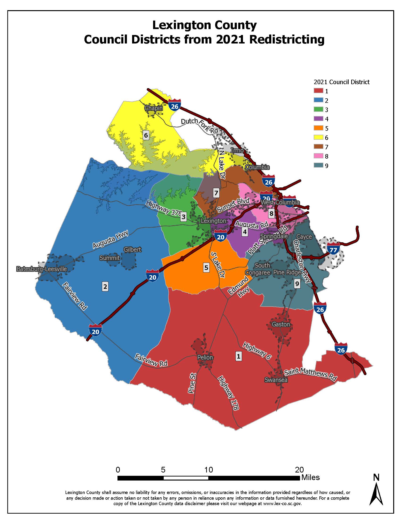
From Lexington County – Jessica Imbimbo – Lexington County Council approved an ordinance to reestablish the nine council districts at a council meeting in January.
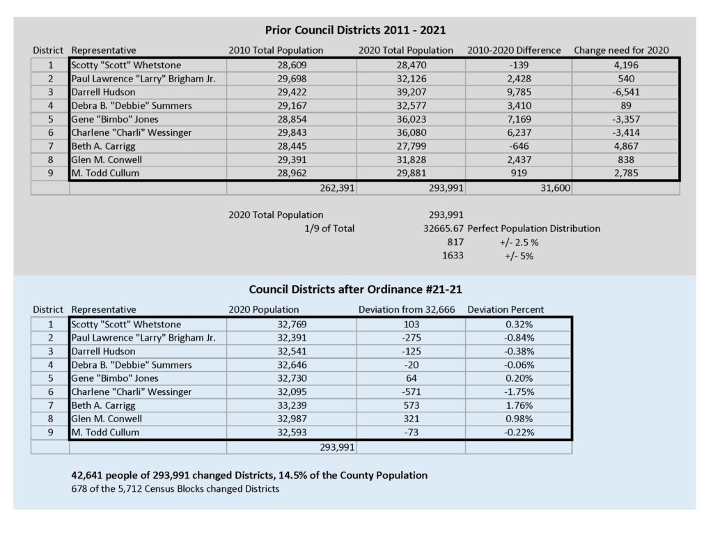
This process, known as redistricting, includes redrawing the lines of the council districts in order to accommodate the population changes recorded by the 2020 Census. This process is required by the Home Rule Act of 1975 and the Code of Laws of South Carolina Section 4-9-90, and is completed following the census every ten years and before the next general election.
As part of the approval process, County Council held three separate readings of the Redistricting ordinance during their council meetings on Nov. 9, Dec. 14, and Jan. 11. County Council also held a public hearing during their meeting on Tuesday, Dec. 14 to hear comments from residents regarding the redistricting plan.
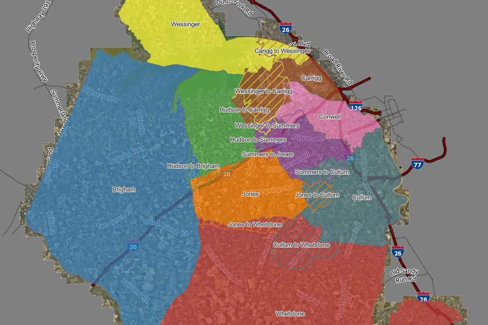
According to the 2020 Census, the population for Lexington County is 293,991 people. Approximately 42,641 Lexington County residents have changed council districts during the redistricting process. That number equals approximately 14.5 percent of the county’s population.
Lexington County residents can review the changes to the districts at the following link: https://lexco-gis.maps.arcgis.com/apps/instant/lookup/index.html?appid=a6616aff09424ec98ff7ffe684f7594b
This app displays council districts under Lexington County’s 2021 redistricting plan and highlights those areas which have changed districts under the new plan. To find information about a location’s council district under the new redistricting plan you can do one of the following actions:
- Click the search box and type in an address
- Click the search box and select “use current location”
- Click a location on the map
- To review all districts again, click the blue box for “Clear search location” at the top of the map
Members of the Lexington County Planning and GIS Department were instrumental in drafting the new council districts and redrawing the maps according to specific guidelines. During the drafting process, the Planning and GIS Department also submitted the maps to the South Carolina Revenue and Fiscal Affairs Office (RFA) for independent approval. This approval is not required, but it is valuable to ensure the validation of the redistricting maps.
During the council meeting on Jan. 11, many of the council members as well as County Administrator Lynn Sturkie recognized the Planning and GIS staff for their efforts in drafting the new districts.
“With the people that participated in the Census, Lexington County grew by over 32,000 people – which is almost a whole other district,” Sturkie said. “I would like to thank the staff from the Planning and GIS Department for all of their hard work in putting the maps together. Their continuous effort in designing and formatting these maps were essential in our redistricting process.”


