


Hurricane Helene expected to cause rain and high winds in Lexington County Thursday evening into Friday morning


Hurricane Helene is expected to make landfall on Florida’s Big Bend (near Tallahassee) Thursday evening as a major category 4 hurricane. Currently, Helene is a category 1 hurricane with maximum sustained winds of 85 MPH. As the hurricane enters the warm waters of the Gulf of Mexico, Early Thursday, it could develop into a category 4 storm with winds near 130 mph. The storm is expected to move northwestward moving toward South Carolina early Friday.
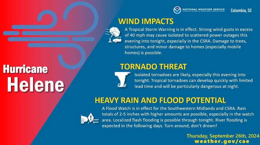
The Hurricane Helene is expected to impact Lexington County with strong winds, and rain. A tropical storm warning has been issued for all of the state of South Carolina. There’s a potential for winds of 39 to 57 miles an hour.
The impact from the storm is predicted to start on Thursday afternoon until midnight and into early Friday morning, possibly lasting until midday. The worst of the it will be later in the night, Thursday, according to the National Weather Service.
Forecasts call for winds from 20-to-40 MPH and 2-to-3 inches of rain. The volume of rain could result in flash floods.